Our Services
Data Maintenance & Conversion
Data Maintenance & Conversion
Data Maintenance & Conversion
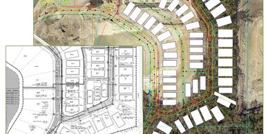
Compass GIS specializes in utility CAD conversion, GIS data creation and updates, and LiDAR and image processing.
Analysis and Visualization
Data Maintenance & Conversion
Data Maintenance & Conversion
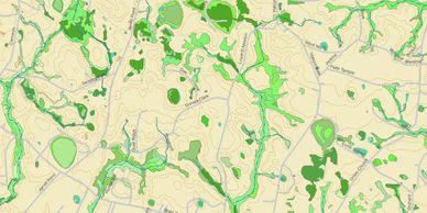
GIS analysis and visualization allow for deeper understanding into data. These methods of using spatial location and attributes reveal relationships and patterns that support decision making, identify and solve problems, and raise awareness.
Mapping Services
Data Maintenance & Conversion
Support & Training
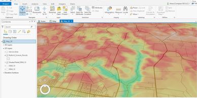
Mapping services vary from basic to comprehensive. Recent maps include: emergency service districts for fire departments, viewshed analysis, environmental and thematic maps for site suitability.
Support & Training
Support & Training
Support & Training
Custom GIS user support and training options are available for ArcGIS Desktop, ArcGIS Pro, and ArcGIS Online software.
Solutions
Support & Training
Solutions
Let us help you discover the geospatial possibilities for your organization or community.